Soil Carbon Farming Science
The science behind Australia’s number 1 soil carbon farming program
Producers in our NetCarbon™ Program have access to world-class soil carbon measurement science and GIS.

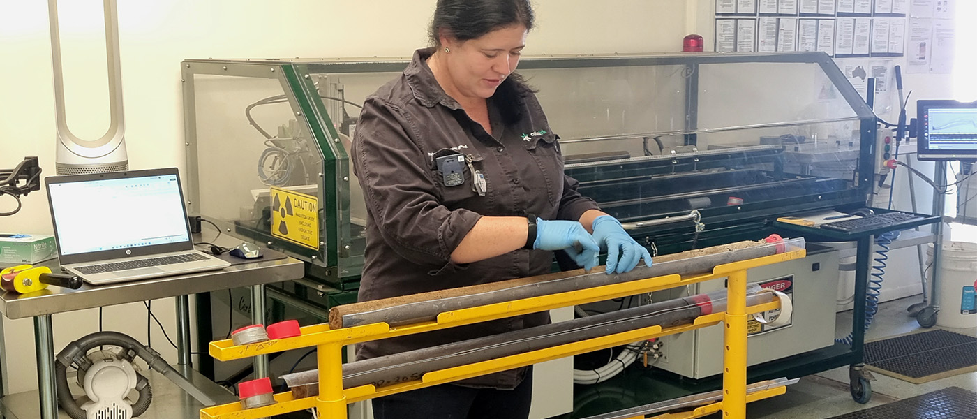
Soil carbon is important because it contributes to soil fertility, soil stability, and soil water retention. Measuring soil carbon is important for producers and land managers because it helps them understand how different management practices affect soil health. Science and GIS technology have made it possible to measure soil carbon more accurately. For example, CarbonLink’s NetScan™ scanning technologies can measure the amount of organic matter in a soil sample with great accuracy.
However, measuring soil carbon is not always straightforward. There can be significant variation in soil carbon levels from one location to another, and even within the same field. This variation can be due to factors such as soil type, plant type, and management practices. As a result, our scientists carefully design sampling programs (collecting soil sample cores to 1200mm) to ensure that they are measuring soil carbon accurately. This is part of the CarbonLink™ Advantage.

Unlock the potential of your soil carbon with NetScan™. Our innovative technology provides in-depth insights into your property’s carbon levels, helping you optimise your soil carbon business for maximum Australian Carbon Credit Units (ACCU) returns. With our advanced sensors and analytics capabilities, leading industry data is at your fingertips – allowing precise analysis about current – and future – carbon yields from your land.
Make sure to take full advantage of potential ACCUs, and maximise your return on investment by unlocking all that is hidden beneath the surface – only with NetScan™


Meet Dr. Julie-Ann Malan, just one of our highly trained scientific team ensuring world-class accuracy when measuring soil organic carbon samples from your property.
Soil samples are taken a depths of 1200mm, more than the industry standard of 300mm. This is done to ensure accuracy and precision when measuring your samples.
Our NetScan™ technology, developed in Australia using ground-breaking science, is unmatched when it comes to scanning precision performance.

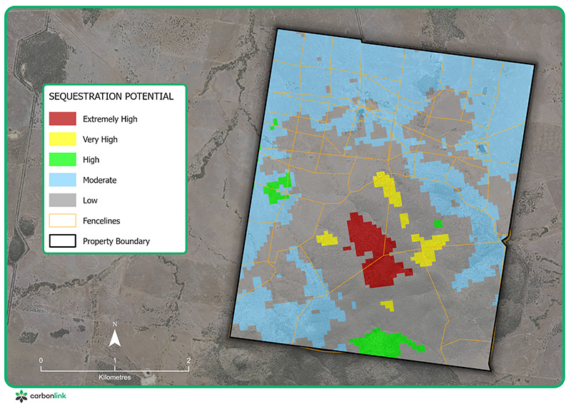
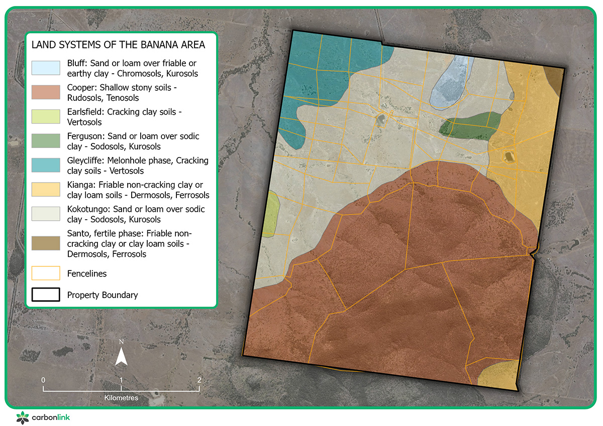
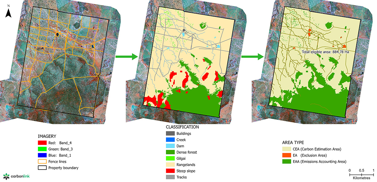
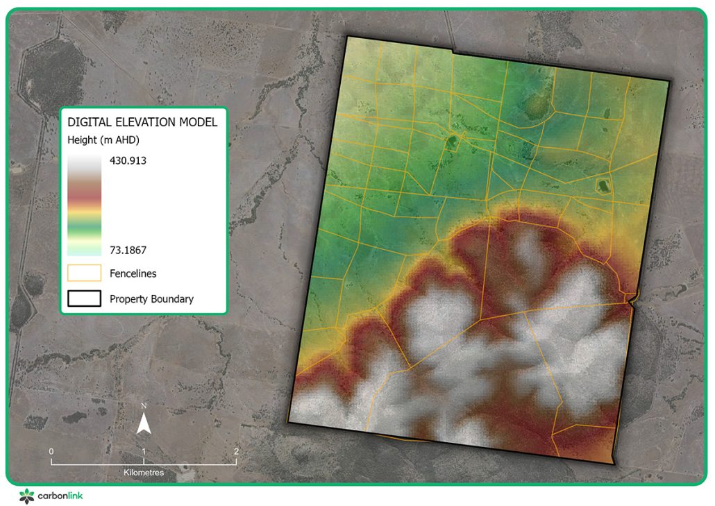
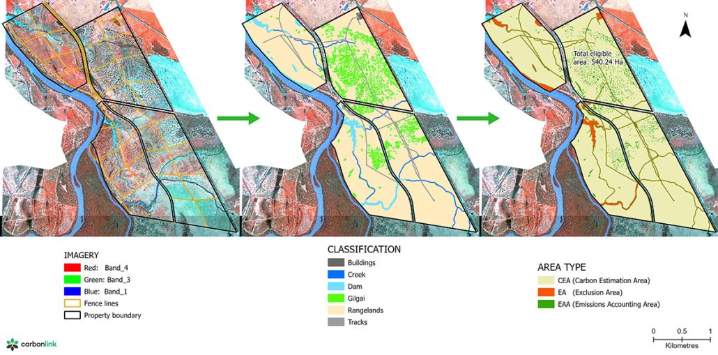
NetSpatial™ is Australia’s leading soil carbon farming mapping service. Powered by an internal team of GIS, remote sensing, and geostatistical experts, our team utilises advanced tools and high-resolution satellite imagery to present your soil carbon farming opportunity in a visual context.
Decades of experience and the application of cutting edge methods and geospatial technology, means your soil carbon farming opportunity will be maximised for success. Along with advanced analytical methods, state-of-the-art machine learning and geostatistical algorithms, we incorporate 3D visualisation to develop accurate and precise soil carbon farming project mapping and field sampling sites.
Below is a small sample of the maps provided in our NetImpact™ Project Planning Reports tailored for your farm.


You’ll receive a copy to your inbox within 24 hours.
